About Bass Lake
There are many Bass Lakes in Ontario and North America. Our Bass Lake is a small lake, situated in the Township of Rideau Lakes. The Township lies in the northwest corner of the United Counties of Leeds and Grenville. Bass Lake is located about 16 kilometers southwest of the Town of Smiths Falls and 14 kilometers south of the Town of Perth.
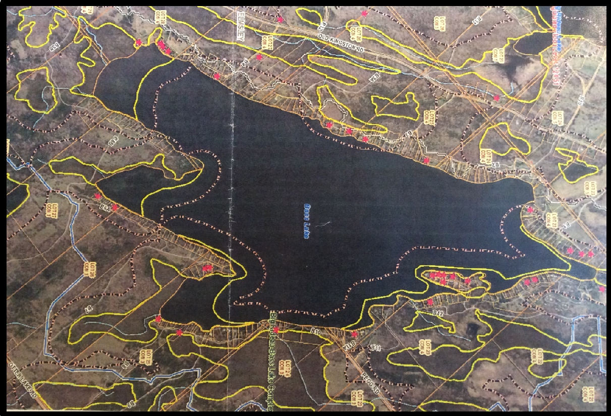
Bass Lake covers a surface area of 717 acres. The shoreline length is 11 kms and the lake elevation is 134 meters above sea level and is part of the Rideau Valley drainage basin. The maximum depth is 22.5 metres and the average depth is 7.3 metres.
Bass Lake is fed by numerous springs although little is known about the volume or source of these springs. There is one primary outlet at the north end of the lake and in the winter & spring water flows down to the Lower Rideau Lake. There is also water loss by surface evaporation, mostly during the summer months.
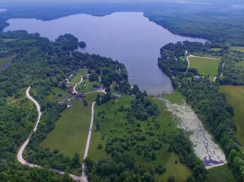
Bass Lake does not have any public beaches or access sites; however, it has two well established recreational business at the north end of the lake with access off Road B12. They are the Bass Lake Lodge & its 10 Chalets and the Bass Lake campground which has 65 lots.
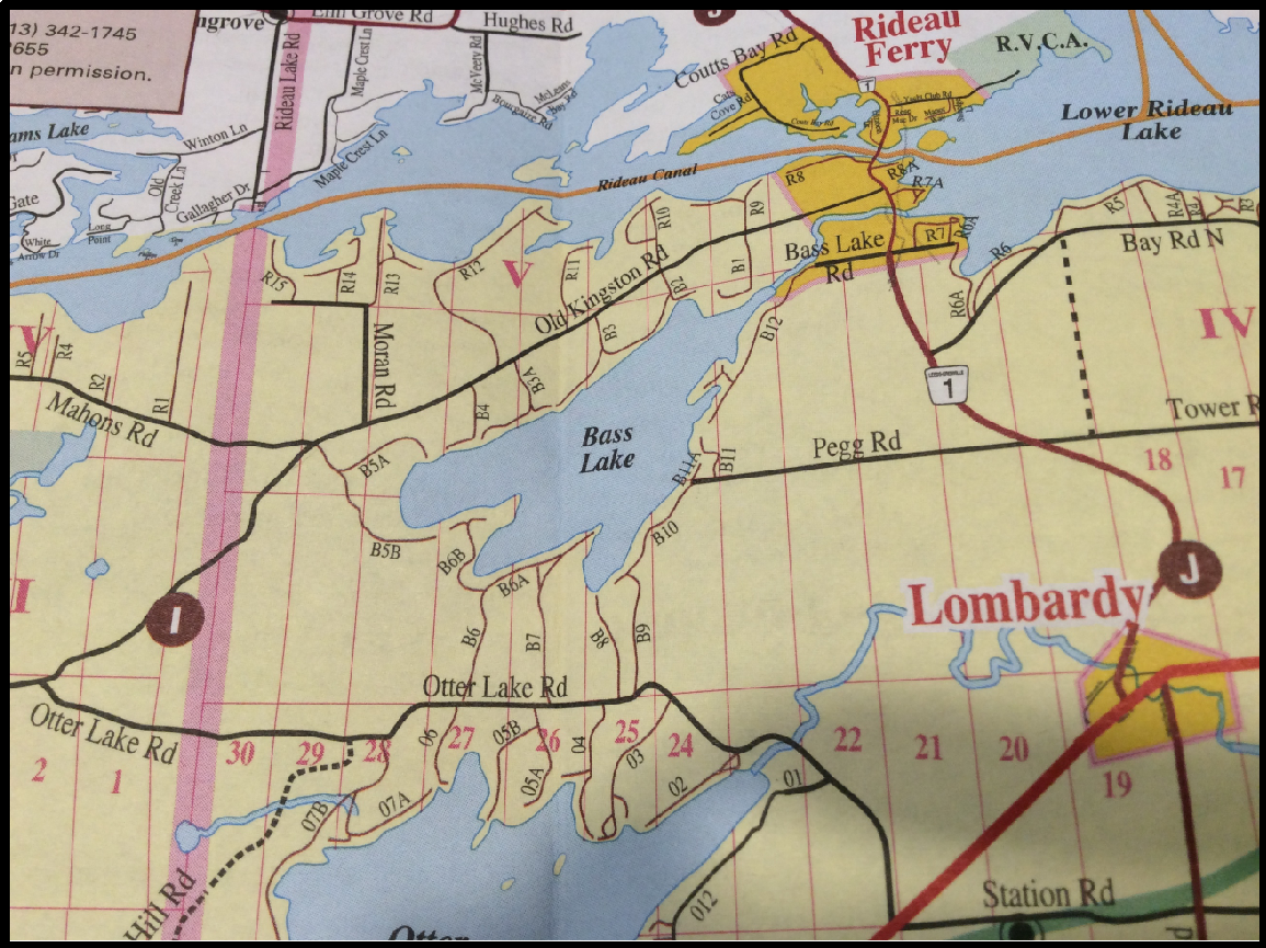
The map shows the location of Bass Lake in respect to other lakes, towns and villages in the surrounding area. Bass Lake lies to the west of Highway 15 and around the full perimeter of the lake there are 13 private roads providing access to 234 waterfront properties. These private roads are accessed from several directions:
Roads B10, B11, B12 - off of County Route 1. Bass Lake Road -B12 and Pegg Road – B10, B11;
Roads B1, B2, B3, B3A, B4, B5 - off of Old Kingston Road and;
Roads B6, B7, B8, B9 - off Otter Lake Road.
Bass Lake is land locked and not part of the Rideau Canal System. It is part of the Lower Rideau Lake catchment area which is located within the physiographic region known as the Smiths Falls Limestone Plain. In this area, the underlying bedrock consists of Paleozoic quartz sandstone, some dolostone and possibly conglomerate. The sediment overlying the bedrock is primarily mixed glacial sediment often referred to as drift.
Around Bass Lake, there are numerous natural protected wetlands areas that are habitat for a variety of aquatic life. The common loon is a frequent summer visitor arriving in early May and often staying until November. The shoreline buffer is made up of settlement areas (65 percent), woodland (16 percent), wetland (15 percent), transportation routes (three percent) and crop and pastureland (one percent).
Fishing - Bass Lake is known to tourists and residents as a good smallmouth bass and northern pike summer fishery. The lake features large shoal areas and these are the prime areas to focus your angling efforts. The bays along the south shore are home to significant weed growth that provide ample structure for the bass and northern pike. There is boat launch located at the Bass Lake Lodge on B12.
Bass Lake lies more or less in a north/south direction, there are often some spectacular sunrises and sunsets that can be viewed from property owners’ docks or decks.